Greenbelt Program
Protecting Ventura County’s Historical, Cultural, and Natural Resources
Greenbelts are voluntary agreements between the Board of Supervisors and one or more City Councils regarding development of agricultural and/or open space areas beyond city limits. They protect open space and agricultural lands and reassure property owners located within these areas that lands will not be prematurely converted to agriculturally incompatible uses.
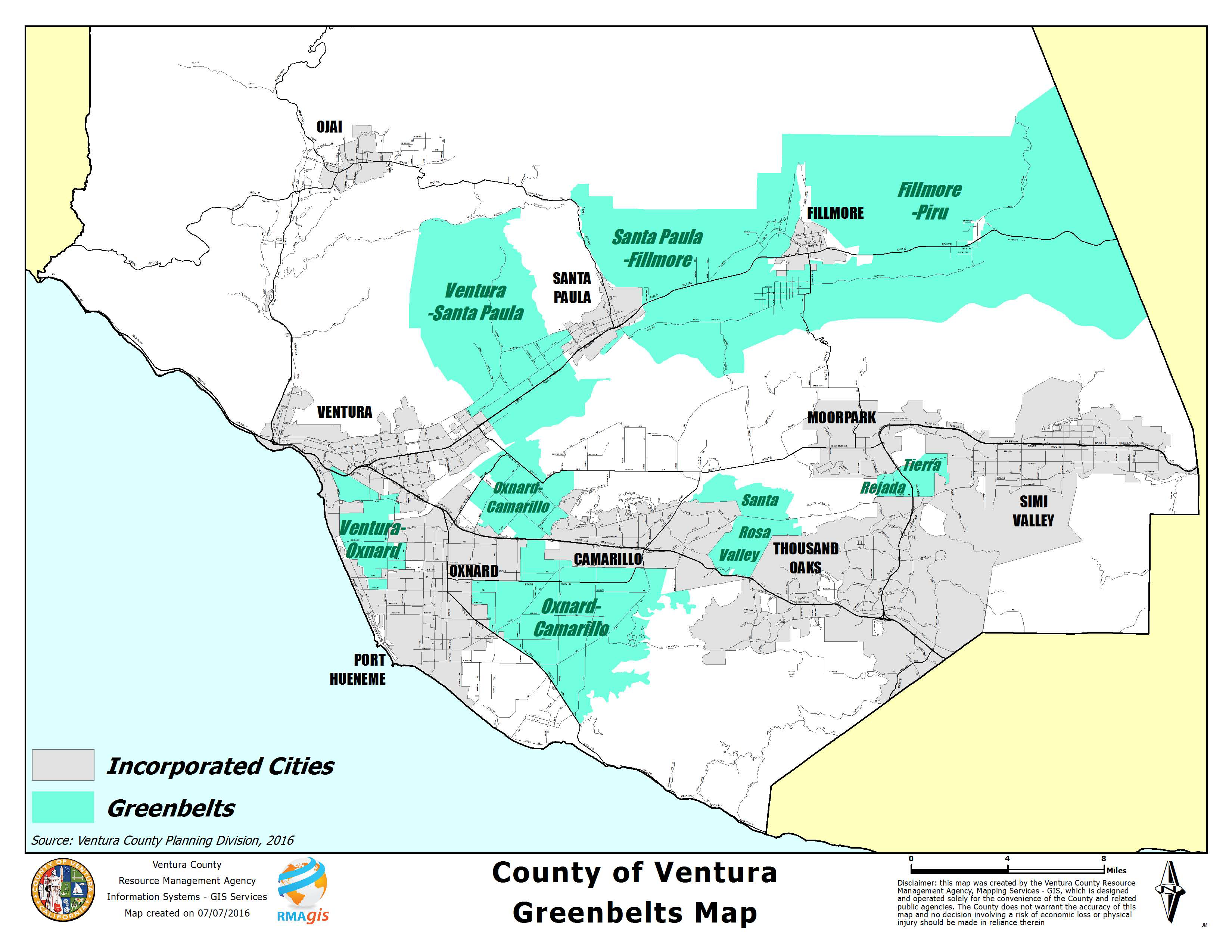
Cities commit to not annex any property within a greenbelt while the Board agrees to restrict development to uses consistent with existing zoning. City and County elected officials of Ventura County were pioneers in designing and adopting greenbelts. The first greenbelt, between the cities of Ventura and Santa Paula, was adopted by the County in 1967. There are now a total of seven in the County. These are:
- The Ventura-Santa Paula Greenbelt
- The Santa Paula-Fillmore Greenbelt
- The Camarillo-Oxnard Greenbelt
- The Santa Rosa Valley Greenbelt
- The Tierra Rejada Greenbelt
- The Ventura-Oxnard Greenbelt
- The Fillmore-Piru Greenbelt
- Countywide map of all existing greenbelts
For more information contact Shelley Sussman at (805) 654-2493 or Shelley.Sussman@ventura.org.